South West Rocks
Now: 9.1 °C
Today:  Partly cloudy.
Tonight: 8 °C
Tomorrow: 23 °C Partly cloudy.
Partly cloudy.
Tonight: 8 °C
Tomorrow: 23 °C Partly cloudy.
Today, Monday: Partly cloudy. Light winds.
Tomorrow, Tuesday: Partly cloudy. The chance of fog in the north in the early morning. Slight chance of a shower. Winds west to northwesterly 15 to 25 km/h becoming light in the evening.
| Temperature | 9.1 °C | |
| Feels like | 7.7 °C | |
| Wet bulb temp. | 9.0 °C | |
| Minimum temp. | 7.5 °C | 11:30pm |
| Maximum temp. | 22.2 °C | 2:27pm |
| Dew point | 8.8 °C | |
| Humidity | 98% | |
| Wind | ||
| Strongest gust | 10:46am | |
| Pressure | 1024.3 hPa | |
| Rain since 9am | 0.0 mm |
Kempsey Airport at 11:50pm.
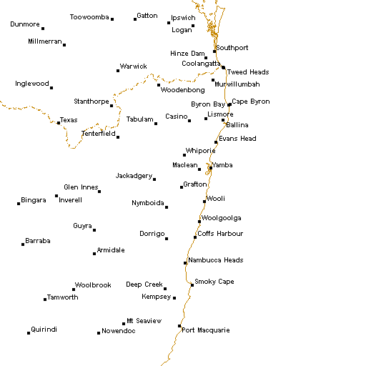
Radar


UV index
| 7am | 0.1 | Low | |
| 8am | 0.6 | Low | |
| 9am | 1.7 | Low | |
| 10am | 3.0 | Moderate | |
| 11am | 4.1 | Moderate | |
| 12pm | 4.4 | Moderate | |
| 1pm | 3.8 | Moderate | |
| 2pm | 2.5 | Moderate | |
| 3pm | 1.2 | Low | |
| 4pm | 0.4 | Low |
Last 72 hours
Today
| Dawn | Sunrise | Sunset | Dusk |
| 6:08am | 6:32am | 5:15pm | 5:40pm |
Tomorrow
| Dawn | Sunrise | Sunset | Dusk |
| 6:07am | 6:31am | 5:16pm | 5:40pm |
Recent days
| Date | Min. | Max. | Rain |
| Mon 3 Aug | 5.1 °C | 0 mm | |
| Sun 2 Aug | 6.3 °C | 20.5 °C | 0.8 mm |
| Sat 1 Aug | 5.3 °C | 19.6 °C | 0 mm |
| Fri 31 Jul | 3.4 °C | 19.1 °C | 0 mm |
| Thu 30 Jul | 1.4 °C | 18.3 °C | 0 mm |
| Wed 29 Jul | 7.0 °C | 23.2 °C | 0.2 mm |
| Tue 28 Jul | 6.4 °C | 22.0 °C | 0 mm |
| Mon 27 Jul | 7.4 °C | 21.2 °C | 0 mm |
Space weather
Kaus seven day history
Next 36 hours
| Time | 10pm | Tue 1am |
4am | 7am | 10am | 1pm | 4pm | 7pm | 10pm | Wed 1am |
4am | 7am |
| Temperature (°C) | 11 | 9 | 8 | 8 | 18 | 23 | 20 | 14 | 10 | 8 | 7 | 6 |
| Chance of rain | 5% | 5% | 5% | 5% | 5% | 10% | 10% | 5% | 5% | 5% | 5% | 0% |
| Median rain (mm) | 0 | 0 | 0 | 0 | 0 | 0 | 0 | 0 | 0 | 0 | - | - |
| Wind speed (km/h) | 22 | 13 | 13 | 11 | 13 | 17 | 20 | 22 | 20 | 15 | 20 | 15 |
| Wind direction | ||||||||||||
| Dew point (°C) | 11 | 9 | 8 | 8 | 9 | 10 | 12 | 12 | 10 | 8 | 7 | 6 |
Next week summary
| Tomorrow Tue 4 Aug |
Wed 5 Aug |
Thu 6 Aug |
Fri 7 Aug |
Sat 8 Aug |
Sun 9 Aug |
Mon 10 Aug |
|||||||||
|
 |
|
|
|
|
|
|||||||||
| Partly cloudy. | Sunny. | Partly cloudy. | Partly cloudy. | Partly cloudy. | Partly cloudy. | Sunny. | |||||||||
| Max. (°C) | 23 | 20 | 20 | 21 | 21 | 22 | 22 | ||||||||
| Min. (°C) | 8 | 6 | 4 | 6 | 6 | 7 | 9 | ||||||||
| Any rain | 20% | 10% | 20% | 30% | 30% | 30% | 20% | ||||||||
| Rain (mm) | 0 | 0 | 0 | 0–1 | 0–1 | 0–1 | 0 | ||||||||
| 7am | 1pm | 7am | 1pm | 7am | 1pm | 7am | 1pm | 7am | 1pm | 7am | 1pm | ||||
| Wind (km/h) | 11 | 17 | 15 | 17 | 13 | 13 | 13 | 15 | 11 | 13 | 15 | 28 | |||
| Wind dir. | |||||||||||||||
| Dew pt. (°C) | 8 | 10 | 6 | 8 | 4 | 9 | 6 | 11 | 6 | 11 | 7 | 12 | |||
Complete forecast
Today, Monday 3 August
Partly cloudy.
5% chance of rain
Partly cloudy. Light winds.
Tomorrow, Tuesday 4 August
Partly cloudy.
Minimum: 8 °C Maximum: 23 °C
20% chance of rain
Partly cloudy. The chance of fog in the north in the early morning. Slight chance of a shower. Winds west to northwesterly 15 to 25 km/h becoming light in the evening.
Sun protection 10:00am to 1:30pm, UV Index predicted to reach 4 [Moderate]
Wednesday 5 August
Sunny.
Minimum: 6 °C Maximum: 20 °C
10% chance of rain
Sunny. Areas of morning frost about higher ground. Light winds becoming northeast to southeasterly 15 to 20 km/h in the early afternoon then becoming light in the late afternoon.
Thursday 6 August
Partly cloudy.
Minimum: 4 °C Maximum: 20 °C
20% chance of rain
Partly cloudy. Areas of morning frost in the south. Light winds. Overnight temperatures falling to between zero and 5 with daytime temperatures reaching between 15 and 20.
Friday 7 August
Partly cloudy.
Minimum: 6 °C Maximum: 21 °C
30% chance of rain 0 to 1 mm
Mostly sunny. The chance of morning fog. Areas of morning frost in the south. Slight chance of a shower along the coastal fringe, near zero chance elsewhere. Light winds.
Saturday 8 August
Partly cloudy.
Minimum: 6 °C Maximum: 21 °C
30% chance of rain 0 to 1 mm
Sunday 9 August
Partly cloudy.
Minimum: 7 °C Maximum: 22 °C
30% chance of rain 0 to 1 mm
Monday 10 August
Sunny.
Minimum: 9 °C Maximum: 22 °C
20% chance of rain
Issued as 9:45pm. Next forecast at 4:15am.
Weather situation
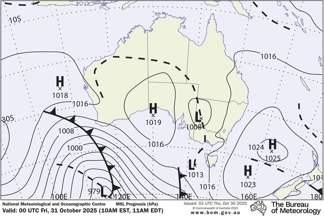
A low pressure system near Tasmania is slow-moving, with its associated cold front crossing the state's south today. Meanwhile, a trough over the interior of Queensland extends into the northern inland of the state, and a high over the Tasman Sea extends a ridge towards the state's northeast. These systems will gradually contract eastwards and weaken as a new high enters the state's west and moves across the state through mid to late this week. Another, stronger cold front is then forecast to cross the state during the weekend, bringing unstable conditions with showers and fresh, gusty westerly winds.
Climate statistics
More details and data sources: